
Finding People Along a Santee Street
A street-by-street search starts with an exact situs address. In Santee, that address can be tested in the County Accela property lookup, parcel tools, maps, permit pages, and the county assessment system. The first result usually identifies land or a project, not a complete household. The goal is to build a stable parcel key before attaching a name to the record.
Use this order so each step adds a new kind of evidence:
- Enter the street number, street name, city, and ZIP in the county address tool; note unit and address-assignment details.
- Capture the APN and inspect the assessor map for lot lines, adjoining parcels, dimensions, and map references.
- Use ARCC's public-information phone or kiosk channel for current owner and address information, keeping mailing and situs addresses distinct.
- Search the owner as a grantee in the 1970-present Official Records Index, then follow each grantor backward through the chain.
- Compare the result with permits, public court context, and verified reverse-directory pages when the question is historical household presence.
Address -> APN -> parcel map -> current owner channel -> deed index -> project and directory evidence
Santee Accela Turns Addresses Into Parcels
San Diego County's Accela property lookup is the most useful official street gateway found in the research. It offers an Address mode and a Parcel information mode. Address mode can search a range of street numbers, which matters when walking a named Santee street, and it can narrow by city or ZIP. The result is property or application context. It is not an open list of people.
| Accela control | Type | Search use | Limit |
|---|---|---|---|
| Search type | Dropdown | Choose Address or Parcel information | Mode changes the fields |
| Street # | Range inputs | Walk a number span on one street | Use exact house numbers when possible |
| Direction | Dropdown | Separate directional street forms | Do not assume a direction |
| Street name and type | Text and dropdown | Pair name with Road, Street, Boulevard, or other type | Street formatting affects matches |
| Unit, city, state, ZIP | Text or dropdown | Narrow a parcel or project search | ZIP is postal, not city jurisdiction |
| Address assignment date | Date pair | Test when an address was assigned | Does not establish a resident |
| Address validation | Dropdown | Separate validated address records | Result still needs parcel review |
The County Accela lookup is the source for these controls. Enter Santee and 92071 only when the address itself supports that filter.
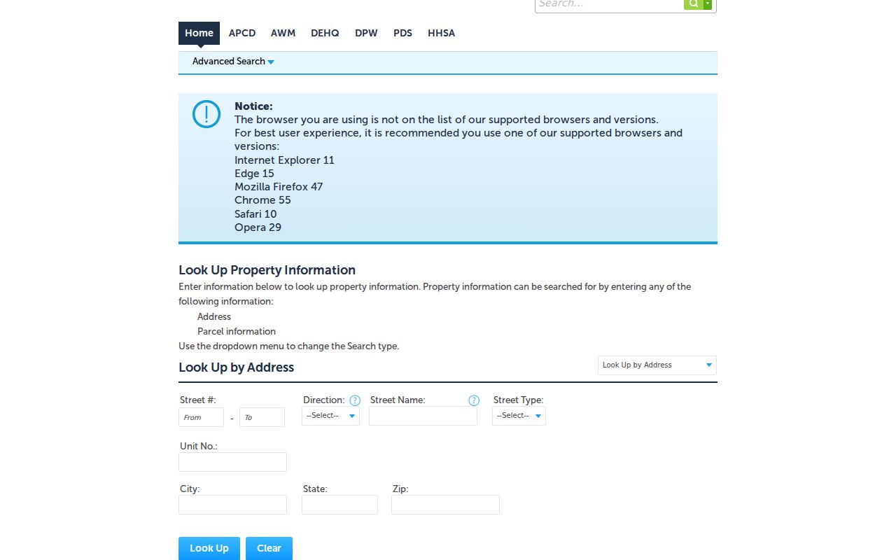
Once an address resolves, preserve the result's parcel or application number before moving to another office.
Santee Assessor Data Needs a Name Check
San Diego County Assessor Property Information supplies the parcel side of a Santee street directory. The current secured-roll search accepts a full APN or a street number with street name. It can return APN, assessment year and lien date, property reference, land and improvement values, exemptions, net taxable value, factored base-year value where relevant, and a reason for an assessment change. The page says the result is information only, not a tax bill.
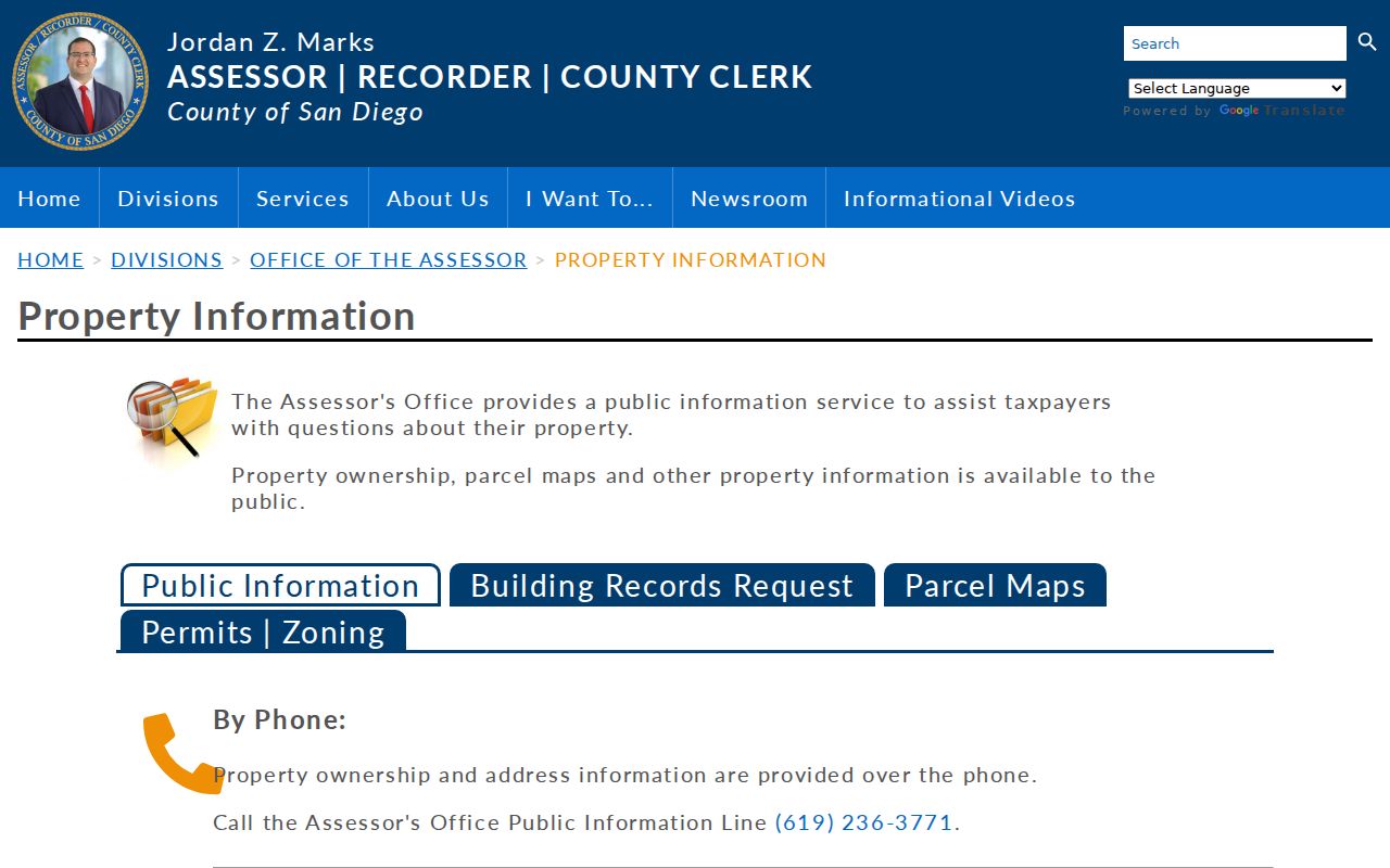
Internet ownership is restricted under Government Code section 6254.21. ARCC documents owner and address information by telephone at 619-236-3771 and at public computer kiosks. ParcelQuest Lite supplies APNs, characteristics, assessed values, and maps, but the county does not document an unrestricted public owner-name field. A current mailing address is where tax correspondence goes. It is not automatically the physical household.
| Parcel Number | Alternative key; full format shown by the county as 123-456-78-90, with a minimum eight-digit form. |
|---|---|
| Street Number and Name | Alternative address key; use the situs address without assuming an owner search. |
| Search / Print | Runs the current secured roll and prints the assessment notice. |
The ARCC assessor property page explains the permitted channels.
The assessor map shows adjacent APNs and lot geometry, but it expressly does not show owner names or street addresses on the map.
Browse Santee Blocks in County GIS
SanGIS and San Diego County GIS applications are useful for seeing how a Santee street fits into a block. The Assessor map supplies APNs, parcel boundaries, dimensions, and recorded-map references. The Survey Records System can search maps, plans, and land records by map position, address, intersection, or record number. Its layers are discovery aids: aerial imagery and parcel lines are not fully registered, so the APN must be checked against the assessor map.
There is no verified automated radius or buffer tool in the reviewed material. To examine nearby parcels, pan or zoom to the target, note the APNs that touch it and those directly across the street, then run each selected parcel through the permitted property-information channel. This map-browse method is more honest than calling a visual layer a resident list.
The SanGIS open-data entry page is the authoritative regional map and data source.
Active-project records add a second time layer. They can explain a new road, tract, or project label without proving who used the address.
Santee's active projects map shows the city planning context for a changing street.
Keep the map's parcel geography separate from names obtained from another custodian.
Santee Street Records by Address
These are the main address-keyed layers behind a Santee street directory. Their access channels are not equal, and no row should be read as a complete household roll.
| Record set | Keeper | What it shows | Access |
|---|---|---|---|
| Parcel and assessment | San Diego ARCC Assessor | APN, values, characteristics, exemptions, parcel context | Parcel tools; phone or kiosk for owner information |
| Assessor map | County Assessor | Lot lines, dimensions, adjacent APNs, map references | Online map and copy counter |
| Recorded instruments | ARCC Recorder | Grantor, grantee, document type, date, number | Free index; kiosk image or ordered copy |
| Survey and subdivision records | County Surveyor | Maps, plans, intersections, corrections, road continuity | Survey Records System and counter |
| Permits and code files | City of Santee | Project address, work history, applicant where disclosed | Santee Portal or focused request |
| Reverse directories | Libraries and archives | Listed address, householder, subscriber, historical context | Catalog and reading-room inquiry |
The parcel number ties several rows together. The street name alone does not. Use the legal description and recording number when an old address form or subdivision label differs from the current one.
Follow a Santee APN Into the Deed Index
The Recorder's Official Records Index covers 1970 to the present. Since December 9, 2024, online APN searching is disabled, while APN search remains available at ARCC kiosks. Online work therefore starts with a current owner name or another indexed key. Search that person as grantee, identify the likely acquisition deed, read the grantor, and search the grantor backward as an earlier grantee.
Record the exact spelling, trust or entity punctuation, document type, recording date, document number, legal description, and APN reference where available. Before 2012, the index may abbreviate entity words because of space limits. Search both expanded and shortened forms. The online index supplies metadata, not the document image. A kiosk or paid copy is needed to read vesting language and the legal description.
ARCC lists $2 for the first copy page, $0.05 for each additional page, and $1 for certification on the cited schedule. Mail orders need the document number, recording year, party, and document type. In-person viewing needs no appointment. At the pre-1970 edge, shift to county indexes, deed books, microfilm, and archives rather than extending the web cutoff by assumption.
- Parcel
- A mapped tax-administration area identified by an APN.
- Situs address
- The physical property location used by parcel, permit, and inspection systems.
- Plat
- A recorded map that lays out lots, blocks, streets, or subdivision lines.
- Criss-cross directory
- A directory arranged by street and number, then a listed household or subscriber.
Permits Add a Santee Address Timeline
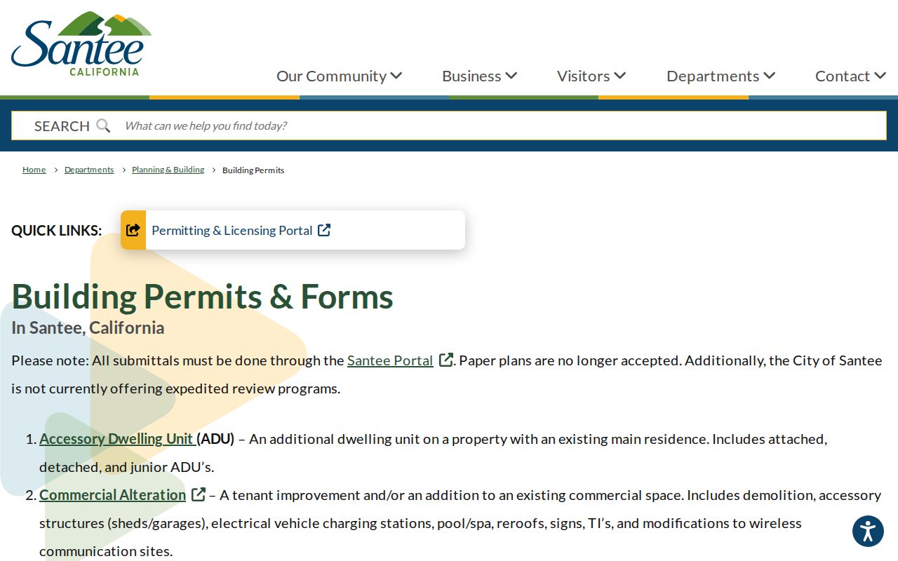
Santee Planning and Building records can place a remodel, new structure, solar system, inspection, code matter, or active project on a dated address timeline. The City says building submittals now go through the Santee Portal and paper plans are no longer accepted. Categories include residential and commercial new work, alterations, accessory dwelling units, batteries, solar systems, and related services. Some controls require an account, so a public landing page is not the same as a public result set.
An applicant, owner-builder, designer, or contractor is a project role. It is not proof that the person lived at the situs. Use the permit date to explain a change in the street record, then confirm title or household presence through the source designed for that question.
The Santee building-permit page is the official entry point.
Older or non-indexed material can be requested from the City Clerk with an address, project description, record type, and date span.
Historic Santee Streets Need Older Names
No authoritative Santee-specific street-renumbering year or systematic grid origin was verified. Use recorded subdivision maps, address-assignment records, Survey Records System corrections, annexation files, and dated directories to prove an equivalence. Do not invent a renumbering event simply because a current search misses an old number.
Historical place names are stronger clues. Search Cowleston, Cowles Station, Santee, Fanita Rancho, and Cowles or Kohls beside a surname, tract, school, or corridor. A pre-1980 record may use county or East County geography even when the modern parcel is inside Santee. This is why the street directory's modern address key must be paired with a historical shelf.
Santee Reverse Directories Bridge the Household Gap
Deeds are strong for title, but they do not list every person who used a home. Reverse or criss-cross directories can connect street and number to a listed householder or telephone subscriber. Alphabetical volumes then add a name, spouse notation, occupation, employer, and alternate address. Exact Santee-inclusive year runs and publishers were not verified, so ask the San Diego Public Library California Room, Santee Library, or Historical Society to confirm the title page and coverage statement.
Check the directory's own abbreviation key. A missing entry can mean an unlisted number, a coverage gap, a new subdivision, a move, or an OCR error. Pair adjacent years with the 1950 census and with deeds or permits. The historical collection itself is treated on the Santee city directory page, while the street directory remains focused on the address chain.
Where a Santee Street Directory Stops
No public street directory in Santee establishes every household. The property roll is about assessment and title channels. The Recorder is about recorded instruments. The voter self-lookup is for the voter, and authorized voter-file releases do not turn into personal block browsing. DMV and utility customer addresses are protected or nonpublic. Renters, children, roommates, visitors, and people using a Safe at Home address may not appear in any lawful source.
Privacy limit. Use address records for lawful personal research, family history, civic review, or property questions. Do not use a Santee street directory to stalk, harass, threaten, or intimidate anyone.
When a result matters, verify with the custodian and keep the record's role intact. A matching name is a lead. A matching parcel, date, legal description, or case number is stronger. The difference protects both accuracy and the people named in the records.